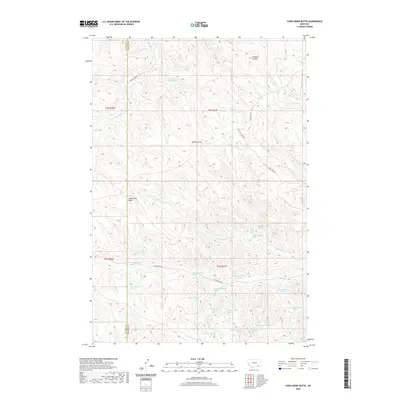
2020 Map of Cook Creek Butte
USGS Topo · Published 2020About this map
Cook Creek Butte rises as a prominent landmark on this high plains landscape along the border of Rosebud and Big Horn counties. The terrain is defined by a dense network of coulees and drainages, most notably the winding Cook Cr and the Saint Johns Fork. A cultural and historical focal point is the Buffalo Jump, suggesting the long-standing significance of these ridges and breaks for regional hunters. The map reveals an intricate system of natural water sources, including Saint Johns Spring and numerous unnamed springs indexed by their geographic coordinates. This 2020 survey documents a ranching and conservation landscape where remote transit via Muddy Creek Rd and Wild Hog Creek Rd follows the natural contours of the drainages, connecting disparate grazing lands across the t4s r41e and t5s r41e townships.
Find a feature on this map
37 named features on this map. Tap any name to fly to it.
Don’t see what you’re looking for? This feature index may not catch every label — zoom into the map to look around manually.
Map Details
Editions of this 2020 Cook Creek Butte Map
This is the sole edition of this map. No revisions or reprints were ever made.
Other maps of this area

1954 · Hardin
USGS Topo · 1:250,000

1957 · Hardin
USGS Topo · 1:250,000

1958 · Hardin
USGS Topo · 1:250,000

1958 · Painted Hill
USGS Topo · 1:24,000

1958 · Bull Creek Lookout
USGS Topo · 1:24,000

1958 · Fisher Butte
USGS Topo · 1:24,000

1958 · Lame Deer
USGS Topo · 1:24,000

1967 · Clubfoot Creek
USGS Topo · 1:24,000

1967 · Birney
USGS Topo · 1:24,000
1967 · Cook Creek Butte
USGS Topo · 1:24,000