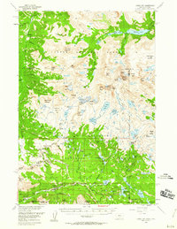
1956 Map of Cooke City
USGS Topo · Published 1960About this map
High-altitude mining and glacial geography define this mid-century survey of the Beartooth and Absaroka ranges. Cooke City and Silver Gate serve as the primary gateways to this remote landscape, where the local economy remained tied to the extraction of mineral wealth. The map documents an extensive mining network south and east of the settlements, including the Glengarry Mines, McLaren Mines, and Irma Mines, alongside smaller operations like the Little Daisy Mine and Shoe Mine.
Find a feature on this map
132 named features on this map. Tap any name to fly to it.
Don’t see what you’re looking for? This feature index may not catch every label — zoom into the map to look around manually.
Map Details
Editions of this 1956 Cooke City Map
5 editions found

Other maps of this area

1886 · Canyon
USGS Topo · 1:125,000

1891 · Livingston
USGS Topo · 1:250,000

1893 · Livingston
USGS Topo · 1:250,000

1895 · Canyon
USGS Topo · 1:125,000

1896 · Canyon
USGS Topo · 1:125,000

1896 · Crandall Creek
USGS Topo · 1:125,000

1898 · Granite Mountain District
USGS Topo · 1:125,000

1899 · Crandall
USGS Topo · 1:125,000

1901 · Canyon
USGS Topo · 1:125,000

1907 · Canyon
USGS Topo · 1:125,000