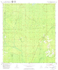
1954 Map of Cooks Hammock
USGS Topo · Published 1979About this map
Cooks Hammock serves as a central point in this mid-century Florida landscape, situated near the headwaters and branches of the Steinhatchee River. The terrain is defined by an intricate network of waterways, including the long reaches of Kettle Creek, Reedy Creek, and Twomile Creek. An industrial history is marked by the presence of an Old Railroad Grade and the Carbur Lookout Tower, which once overlooked the timber and turpentine operations of the region. This 1954 topography shows the area before modern drainage changes, preserving the original extent of low-lying features like Coon Bay and the varied ponds such as Ever Pond and Wolf Pond. The boundary between Taylor and Lafayette Counties bisects the western half of the map, threading through dense wetlands and seasonal branches.
Find a feature on this map
26 named features on this map. Tap any name to fly to it.
Don’t see what you’re looking for? This feature index may not catch every label — zoom into the map to look around manually.
Map Details
Editions of this 1954 Cooks Hammock Map
3 editions found
Other maps of this area

1954 · Mallory Swamp NW
USGS Topo · 1:24,000

1954 · Fenholloway
USGS Topo · 1:24,000

1954 · Day SE
USGS Topo · 1:24,000

1954 · Clara
USGS Topo · 1:24,000

1954 · Salem SW
USGS Topo · 1:24,000

1954 · Mallory Swamp SW
USGS Topo · 1:24,000

1954 · Cooks Hammock
USGS Topo · 1:24,000

1954 · Salem
USGS Topo · 1:24,000

1954 · Gainesville
USGS Topo · 1:250,000

1954 · Valdosta
USGS Topo · 1:250,000