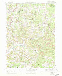
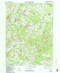
1969 Map of Coolspring
USGS Topo · Published 1972About this map
Pittsburg and Shawmut rail lines and numerous strip mines define the industrial landscape of Jefferson County during the late 1960s. This survey reveals a region defined by extraction and small-town resilience, where settlements like Knox Dale and Coolspring are interspersed with dozens of gas wells. The terrain is deeply etched by a dense network of waterways, including Little Sandy Creek and Rattlesnake Run, which navigate the high ridges of Rose and Knox townships. Local history is preserved in the distribution of rural landmarks, from the Burkett Hollow Ch and Meade Chapel to the Coolspring Cems. Large tracts of the southeastern corner are dedicated to State Game Lands No 31, highlighting the transition between active coal production and protected natural territory.
Find a feature on this map
51 named features on this map. Tap any name to fly to it.
Don’t see what you’re looking for? This feature index may not catch every label — zoom into the map to look around manually.
Map Details
Editions of this 1969 Coolspring Map
5 editions found
Other maps of this area

1906 · Punxsutawney
USGS Topo · 1:62,500

1909 · Smicksburg
USGS Topo · 1:62,500

1922 · Du Bois
USGS Topo · 1:62,500

1924 · Du Bois
USGS Topo · 1:62,500

1924 · Brookville
USGS Topo · 1:62,500

1926 · Brookville
USGS Topo · 1:62,500

1938 · Smicksburg
USGS Topo · 1:62,500

1939 · Smicksburg
USGS Topo · 1:62,500

1939 · Punxsutawney
USGS Topo · 1:62,500

1942 · Punxsutawney
USGS Topo · 1:62,500
Featured Places
- Pine Creek Township, PA
- Knox Township, PA
- Rose Township, PA
- Sprankle Mills, Oliver Township
- Oliver Township, PA