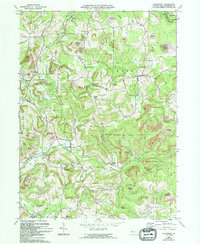
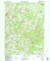
1969 Map of Coolspring
USGS Topo · Published 1994About this map
Sandy Lick Cr and Sandy Creek define the drainage of this Pennsylvania landscape, where extractive industry and rural settlement intersect. The terrain is heavily marked by both strip mines and reclaimed strip mines, particularly around Ramsaytown and Knox Dale. These industrial scars are interspersed with numerous small communities and religious centers, reflecting the area's social fabric. Genealogy researchers will find significant value in the distribution of local burial grounds and places of worship, including St Johns Cem, Meade Chapel, and Burkett Hollow Ch. The southern portion of the map is dominated by State Game Lands No 31, showing a shift from industrial use toward managed natural areas. Smaller hamlets like Coolspring, Markton, and Sprankle Mills anchor the valleys, connected by a network of rural roads and a crossing pipeline.
Find a feature on this map
53 named features on this map. Tap any name to fly to it.
Don’t see what you’re looking for? This feature index may not catch every label — zoom into the map to look around manually.
Map Details
Editions of this 1969 Coolspring Map
5 editions found
Other maps of this area

1906 · Punxsutawney
USGS Topo · 1:62,500

1909 · Smicksburg
USGS Topo · 1:62,500

1922 · Du Bois
USGS Topo · 1:62,500

1924 · Du Bois
USGS Topo · 1:62,500

1924 · Brookville
USGS Topo · 1:62,500

1926 · Brookville
USGS Topo · 1:62,500

1938 · Smicksburg
USGS Topo · 1:62,500

1939 · Smicksburg
USGS Topo · 1:62,500

1939 · Punxsutawney
USGS Topo · 1:62,500

1942 · Punxsutawney
USGS Topo · 1:62,500
Featured Places
- Pine Creek Township, PA
- Knox Township, PA
- Rose Township, PA
- Sprankle Mills, Oliver Township
- Oliver Township, PA