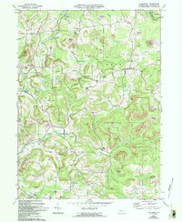
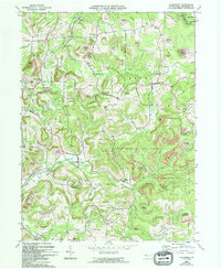
1969 Map of Coolspring
USGS Topo · Published 1994About this map
Knox Dale and Coolspring anchor this landscape during a period of extensive land reclamation and energy extraction. The map reveals a countryside characterized by numerous Reclaimed Strip Mines and scattered Gas Wells, illustrating the region's heavy reliance on subsurface resources. Despite this industrial footprint, older community foundations remain prominent through a network of small settlements and rural landmarks. Genealogists will find significant value in the documentation of local burial sites, including St Johns Cem, Coolspring Cems, and the Burkett Hollow Ch Cem near Markton. The terrain is deeply incised by waterways like Sandy Lick Creek and Little Sandy Creek, which historically dictated the placement of hamlets like Tait and Colon. Much of the eastern portion is dedicated to the State Game Lands No 31, preserving a stretch of forest between the Middle Branch Sandy Creek and Hickok Run.
Find a feature on this map
51 named features on this map. Tap any name to fly to it.
Don’t see what you’re looking for? This feature index may not catch every label — zoom into the map to look around manually.
Map Details
Editions of this 1969 Coolspring Map
5 editions found
Other maps of this area

1906 · Punxsutawney
USGS Topo · 1:62,500

1909 · Smicksburg
USGS Topo · 1:62,500

1922 · Du Bois
USGS Topo · 1:62,500

1924 · Du Bois
USGS Topo · 1:62,500

1924 · Brookville
USGS Topo · 1:62,500

1926 · Brookville
USGS Topo · 1:62,500

1938 · Smicksburg
USGS Topo · 1:62,500

1939 · Smicksburg
USGS Topo · 1:62,500

1939 · Punxsutawney
USGS Topo · 1:62,500

1942 · Punxsutawney
USGS Topo · 1:62,500
Featured Places
- Pine Creek Township, PA
- Knox Township, PA
- Rose Township, PA
- Sprankle Mills, Oliver Township
- Oliver Township, PA