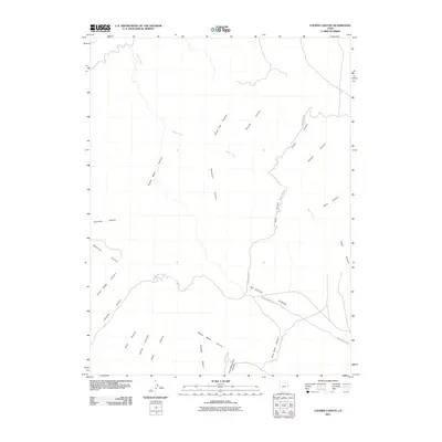
2011 Map of Cooper Canyon
USGS Topo · Published 2011About this map
Bitter Creek meanders through a labyrinth of high-desert drainage systems in this part of Uintah County, creating a deeply dissected landscape defined by dramatic topographical relief. The area's character is established by its numerous named canyons, such as Death Trap Canyon, Suicide Canyon, and Slick Rock Canyon, which indicate the challenging and varied nature of the terrain. Human presence in this isolated section of the Uinta Basin is primarily represented by back-country routes including Indian Ridge Rd and McCook Ridge Rd, which follow the higher elevations of Indian Ridge and Mc Cook Ridge. These ridges served as vital travel corridors through a region otherwise dominated by complex washes like Sweet Water Canyon and Pete Canyon. This map provides a detailed look at the geographical naming conventions of the American West, where local features such as Klondike Canyon and Nelson Canyon reflect the legacy of early land users.
Find a feature on this map
22 named features on this map. Tap any name to fly to it.
Don’t see what you’re looking for? This feature index may not catch every label — zoom into the map to look around manually.
Map Details
Editions of this 2011 Cooper Canyon Map
This is the sole edition of this map. No revisions or reprints were ever made.
Other maps of this area

1885 · East Tavaputs
USGS Topo · 1:250,000

1956 · Grand Junction
USGS Topo · 1:250,000

1959 · Grand Junction
USGS Topo · 1:250,000

1960 · Grand Junction
USGS Topo · 1:250,000

1962 · Grand Junction
USGS Topo · 1:250,000

1964 · Grand Junction
USGS Topo · 1:250,000

1965 · Grand Junction
USGS Topo · 1:250,000

1966 · Seep Canyon
USGS Topo · 1:24,000

1966 · Bates Knolls
USGS Topo · 1:24,000

1966 · Tom Patterson Canyon
USGS Topo · 1:24,000