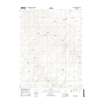
2014 Map of Cooper Canyon
USGS Topo · Published 2014About this map
Bitter Cr carves a winding path through this corner of Uintah County, creating a deeply eroded landscape defined by a network of steep canyons and high ridges. The area is marked by distinctive topographical features like Death Trap Canyon, Suicide Canyon, and Cooper Canyon, reflecting the challenging terrain of the region. The map shows the Sebaco Survey in the northwest, suggesting early land management or mineral exploration interests in this part of Utah.
Find a feature on this map
35 named features on this map. Tap any name to fly to it.
Don’t see what you’re looking for? This feature index may not catch every label — zoom into the map to look around manually.
Map Details
Editions of this 2014 Cooper Canyon Map
This is the sole edition of this map. No revisions or reprints were ever made.
Other maps of this area

1885 · East Tavaputs
USGS Topo · 1:250,000

1956 · Grand Junction
USGS Topo · 1:250,000

1959 · Grand Junction
USGS Topo · 1:250,000

1960 · Grand Junction
USGS Topo · 1:250,000

1962 · Grand Junction
USGS Topo · 1:250,000

1964 · Grand Junction
USGS Topo · 1:250,000

1965 · Grand Junction
USGS Topo · 1:250,000

1966 · Seep Canyon
USGS Topo · 1:24,000

1966 · Bates Knolls
USGS Topo · 1:24,000

1966 · Tom Patterson Canyon
USGS Topo · 1:24,000