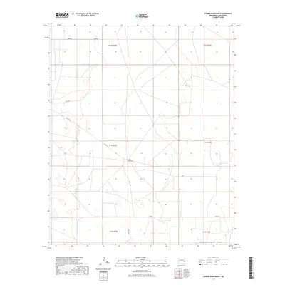
2020 Map of Cooper-Good Ranch
USGS Topo · Published 2020About this map
Cooper-Good Ranch serves as the central landmark for this section of Lea County, marking a landscape defined by the expansive ranching operations of the High Plains. Located at the intersection of several remote rural routes including Priscilla Rd and T-159, the ranch represents the sparse but enduring settlement pattern of the Llano Estacado. The terrain is notably open, with the map recording the Public Land Survey System grids such as t13s r32e and t13s r33e that dictate land ownership and cattle management across this arid region. Aside from the namesake ranch, the map traces the critical infrastructure of the high desert, specifically the unpaved local connectors like Grose Rd and Co Rd 159 which navigate the flat, featureless plains to link distant homesteads and grazing lands.
Find a feature on this map
13 named features on this map. Tap any name to fly to it.
Don’t see what you’re looking for? This feature index may not catch every label — zoom into the map to look around manually.
Map Details
Editions of this 2020 Cooper-Good Ranch Map
This is the sole edition of this map. No revisions or reprints were ever made.
Other maps of this area

1954 · Brownfield
USGS Topo · 1:250,000

1958 · Brownfield
USGS Topo · 1:250,000

1962 · Brownfield
USGS Topo · 1:250,000

1973 · Mescalero Point
USGS Topo · 1:24,000

1973 · Fort Ranch
USGS Topo · 1:24,000

1973 · Soldier Hill
USGS Topo · 1:24,000

1973 · Caudill Ranch
USGS Topo · 1:24,000

1973 · Cooper-Good Ranch
USGS Topo · 1:24,000

1973 · Dean Ranch
USGS Topo · 1:24,000
1973 · Cedar Point SE
USGS Topo · 1:24,000