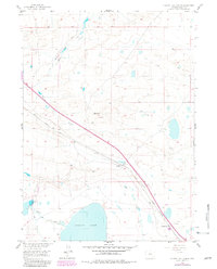
1955 Map of Cooper Lake North
USGS Topo · Published 1982About this map
The northern reaches of Cooper Lake anchor this high plains landscape in Albany County, Wyoming. The terrain is defined by a network of water management features and transportation corridors that reflect the region’s ranching and transit history. The Union Pacific railroad cuts diagonally across the quadrangle, passing through the site of Lookout, where the topography rises distinctly above the surrounding flats. Parallel to the modern rails, the Old Railroad Grade remains visible, marking the evolving path of industrial infrastructure in the West.
Find a feature on this map
12 named features on this map. Tap any name to fly to it.
Don’t see what you’re looking for? This feature index may not catch every label — zoom into the map to look around manually.
Map Details
Editions of this 1955 Cooper Lake North Map
2 editions found
Other maps of this area

1954 · Cheyenne
USGS Topo · 1:250,000

1955 · Bosler
USGS Topo · 1:24,000

1955 · Big Judson
USGS Topo · 1:24,000

1955 · Mc Gill Lakes
USGS Topo · 1:24,000

1955 · Cooper Lake South
USGS Topo · 1:24,000

1955 · Cooper Lake North
USGS Topo · 1:24,000

1955 · Lake Ione
USGS Topo · 1:24,000

1955 · Rock River
USGS Topo · 1:24,000

1955 · Cannonball Cut
USGS Topo · 1:24,000

1955 · Wilcox
USGS Topo · 1:24,000