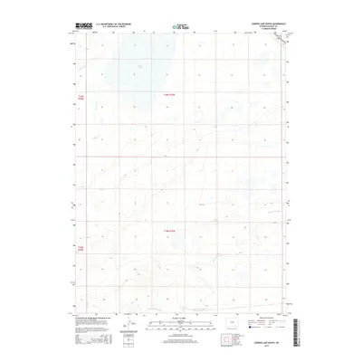
2015 Map of Cooper Lake South
USGS Topo · Published 2015About this map
Cooper Lake dominates the northern landscape of this Albany County region, situated within the vast open country defined by the Public Land Survey System sections of t19n r75w and t18n r75w. The hydrology of this high-plains environment is characterized by a network of water management features, including the winding course of Cooper Creek and the man-made James Lake N Canal. These irrigation and drainage works, along with the Homer Ditch, illustrate the historical development of water rights and land use in southern Wyoming. Transportation through this terrain is primarily served by the corridor of Route 30 287, which cuts through the northeastern corner, providing a vital link across the semi-arid basins of the Laramie Plains.
Find a feature on this map
9 named features on this map. Tap any name to fly to it.
Don’t see what you’re looking for? This feature index may not catch every label — zoom into the map to look around manually.
Map Details
Editions of this 2015 Cooper Lake South Map
This is the sole edition of this map. No revisions or reprints were ever made.
Other maps of this area

1895 · Laramie
USGS Topo · 1:125,000

1902 · Laramie
USGS Topo · 1:125,000

1905 · Laramie
USGS Topo · 1:125,000

1906 · Laramie
USGS Topo · 1:125,000

1908 · Laramie
USGS Topo · 1:125,000

1954 · Cheyenne
USGS Topo · 1:250,000

1955 · Bosler
USGS Topo · 1:24,000

1955 · Big Judson
USGS Topo · 1:24,000

1955 · Cooper Lake South
USGS Topo · 1:24,000

1955 · Cooper Lake North
USGS Topo · 1:24,000