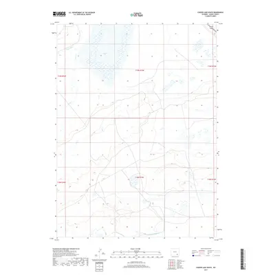
2017 Map of Cooper Lake South
USGS Topo · Published 2017About this map
Cooper Lake dominates the high plains landscape of this Albany County quadrangle, situated within a network of water management features designed for the semi-arid environment. The hydrology of the area is defined by the flow of Cooper Creek and the man-made infrastructure of the Homer Ditch in the northwest and the James Lake N Canal along the southern border. These features indicate the region's reliance on irrigation and water diversion to support the cattle ranching and agricultural operations that characterize this part of Wyoming. The map provides a precise look at the township and range divisions, such as t19n r75w, which dictate the land ownership patterns and grazing allotments in the expansive territory surrounding the lake.
Find a feature on this map
10 named features on this map. Tap any name to fly to it.
Don’t see what you’re looking for? This feature index may not catch every label — zoom into the map to look around manually.
Map Details
Editions of this 2017 Cooper Lake South Map
This is the sole edition of this map. No revisions or reprints were ever made.
Other maps of this area

1895 · Laramie
USGS Topo · 1:125,000

1902 · Laramie
USGS Topo · 1:125,000

1905 · Laramie
USGS Topo · 1:125,000

1906 · Laramie
USGS Topo · 1:125,000

1908 · Laramie
USGS Topo · 1:125,000

1954 · Cheyenne
USGS Topo · 1:250,000

1955 · Bosler
USGS Topo · 1:24,000

1955 · Big Judson
USGS Topo · 1:24,000

1955 · Cooper Lake South
USGS Topo · 1:24,000

1955 · Cooper Lake North
USGS Topo · 1:24,000