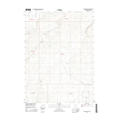
2015 Map of Cooper Ridge NE
USGS Topo · Published 2015About this map
Cooper Ridge and the high desert terrain of Sweetwater County define this landscape as it appeared in the mid-2010s. The area is characterized by a series of significant drainage features, including the sprawling Big Flat Draw, Pinnacle Draw, and Williams Draw, which channel intermittent runoff through the high plains. The transport network reflects the region's energy and ranching infrastructure, with Brady Field Rd and Brady Plant Rd providing access to local industrial sites. Water is scarce but historically significant in this environment, represented here by the Black Buttes Cr and the drainage at Sand Wash. This topographic study by the U.S. Geological Survey shows how modern roads like Co Road 24 and Patrick Draw Rd follow the natural contours and established pathways of this portion of southern Wyoming.
Find a feature on this map
19 named features on this map. Tap any name to fly to it.
Don’t see what you’re looking for? This feature index may not catch every label — zoom into the map to look around manually.
Map Details
Editions of this 2015 Cooper Ridge NE Map
This is the sole edition of this map. No revisions or reprints were ever made.
Other maps of this area

1954 · Rock Springs
USGS Topo · 1:250,000

1958 · Rock Springs
USGS Topo · 1:250,000

1962 · Rock Springs
USGS Topo · 1:250,000

1968 · Cooper Ridge NE
USGS Topo · 1:24,000

1968 · Point Of Rocks SW
USGS Topo · 1:24,000

1968 · Sand Butte Rim NW
USGS Topo · 1:24,000

1968 · Mud Springs Ranch
USGS Topo · 1:24,000

1968 · Black Buttes
USGS Topo · 1:24,000

1968 · Pine Butte
USGS Topo · 1:24,000

1968 · Camel Rock
USGS Topo · 1:24,000