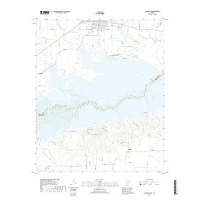
2019 Map of Cooper South
USGS Topo · Published 2019About this map
Cooper marks the northern edge of this North Texas landscape, where the town street grid meets the broad waters of the South Sulphur River valley. This 2019 survey captures the region following the creation of the large reservoir that now dominates the central terrain, submerging much of the historical floodplains of Doctors Cr and Cedar Cr. The map preserves the locations of numerous family and community burial grounds that border the water, including Dawson Cem, Tucker Cem, and Oak Lawn Cem. South of the river, the terrain rises toward Harpers Hill, where the smaller settlements of Klondike and Posey anchor a network of farm-to-market roads and county lanes. The geography here is defined by the transition from established prairie farmsteads to the managed recreational and conservation lands surrounding the river's path through Delta and Hopkins counties.
Find a feature on this map
76 named features on this map. Tap any name to fly to it.
Don’t see what you’re looking for? This feature index may not catch every label — zoom into the map to look around manually.
Map Details
Editions of this 2019 Cooper South Map
This is the sole edition of this map. No revisions or reprints were ever made.
Other maps of this area

1953 · Texarkana
USGS Topo · 1:250,000

1956 · Texarkana
USGS Topo · 1:250,000

1964 · Cumby
USGS Topo · 1:24,000

1964 · Sulphur Springs
USGS Topo · 1:24,000

1964 · Gafford Chapel
USGS Topo · 1:24,000

1964 · Klondike
USGS Topo · 1:24,000

1964 · Charleston
USGS Topo · 1:24,000

1964 · Tira
USGS Topo · 1:24,000

1964 · Cooper North
USGS Topo · 1:24,000

1964 · Pecan Gap
USGS Topo · 1:24,000