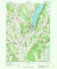
1943 Map of Cooperstown
USGS Topo · Published 1970About this map
The Susquehanna River flows south from the foot of Otsego Lake, serving as the central artery for this mid-20th-century landscape. This mapping, based on 1942 aerial photography, documents the village of Cooperstown as a well-established hub of commerce and education, featuring landmarks like the Knox Sch and Point Judith Kingfisher Tower. The industrial legacy of the region is evident in settlements such as Phoenix Mills and Pail Shop Corners, while the transport network is defined by the Delaware and Hudson railroad lines and several abandoned rights-of-way.
Find a feature on this map
68 named features on this map. Tap any name to fly to it.
Don’t see what you’re looking for? This feature index may not catch every label — zoom into the map to look around manually.
Map Details
Editions of this 1943 Cooperstown Map
4 editions found
Other maps of this area

1903 · Richfield Springs
USGS Topo · 1:62,500

1907 · Winfield
USGS Topo · 1:62,500

1907 · Cooperstown
USGS Topo · 1:62,500

1909 · Cooperstown
USGS Topo · 1:62,500

1910 · Hartwick
USGS Topo · 1:62,500

1912 · Hartwick
USGS Topo · 1:62,500

1943 · Schuyler Lake
USGS Topo · 1:24,000

1943 · Mt Vision
USGS Topo · 1:24,000

1943 · Milford
USGS Topo · 1:24,000

1943 · Richfield Springs
USGS Topo · 1:24,000