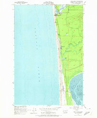
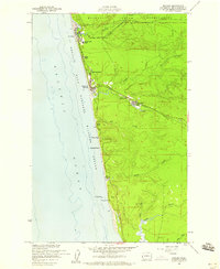
1955 Map of Copalis Beach
USGS Topo · Published 1973About this map
Copalis Beach and the coastal settlements of Grays Harbor County define this mid-century survey of the Washington shore. The landscape is dominated by the shifting Sand Dunes that separate the Pacific Ocean from a series of inland waterways and lowlands, including the meandering Connor Creek and Cranberry Creek. The map documents a period of coastal life where small clusters of development like Ocean City, Sampson, and Oyhut are linked by a narrow corridor between the dunes and the marshy interior. To the north, the Copalis River flows into the sea, while the southern portion of the sheet reveals the complex hydrology of the North Bay with its expansive Tidal Flat and the Oyhut Channel. Local landmarks such as Lang Lake and a small Cem provide specific points of interest for those tracing the geographic history of this peninsula.
Find a feature on this map
16 named features on this map. Tap any name to fly to it.
Don’t see what you’re looking for? This feature index may not catch every label — zoom into the map to look around manually.
Map Details
Editions of this 1955 Copalis Beach Map
5 editions found
Other maps of this area

1938 · Moclips
USGS Topo · 1:62,500

1941 · Moclips
USGS Topo · 1:62,500

1941 · Grayland
USGS Topo · 1:62,500

1943 · Copalis Beach
USGS Topo · 1:250,000

1951 · Copalis Beach
USGS Topo · 1:250,000

1955 · Point Brown
USGS Topo · 1:24,000

1955 · Carlisle
USGS Topo · 1:24,000

1955 · Copalis Beach
USGS Topo · 1:24,000
1955 · Moclips
USGS Topo · 1:24,000

1956 · Copalis Crossing
USGS Topo · 1:24,000