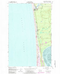
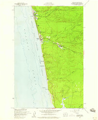
1955 Map of Copalis Beach
USGS Topo · Published 1984About this map
The Copalis River meanders into the Pacific Ocean at the northern edge of this coastal survey, where the settlement of Copalis Beach marks the shoreline. Moving south along the Grays Harbor coast, the landscape is defined by extensive sand dunes and low-lying wetlands, including a significant Cranberry Bog and the waters of Lang Lake. The mid-century development of the region is evident in the transition from established beach communities to the growing recreation and residential areas around Ocean City and Ocean Shores.
Find a feature on this map
22 named features on this map. Tap any name to fly to it.
Don’t see what you’re looking for? This feature index may not catch every label — zoom into the map to look around manually.
Map Details
Editions of this 1955 Copalis Beach Map
5 editions found
Other maps of this area

1938 · Moclips
USGS Topo · 1:62,500

1941 · Moclips
USGS Topo · 1:62,500

1941 · Grayland
USGS Topo · 1:62,500

1943 · Copalis Beach
USGS Topo · 1:250,000

1951 · Copalis Beach
USGS Topo · 1:250,000

1955 · Point Brown
USGS Topo · 1:24,000

1955 · Carlisle
USGS Topo · 1:24,000

1955 · Copalis Beach
USGS Topo · 1:24,000
1955 · Moclips
USGS Topo · 1:24,000

1956 · Copalis Crossing
USGS Topo · 1:24,000