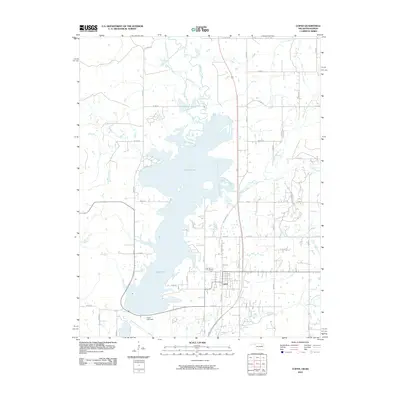
2010 Map of Copan
USGS Topo · Published 2010About this map
Copan Lake dominates the central landscape of this Washington County survey, a large reservoir created by the Copan Lake Dam on the Little Caney River. The settlement of Copan lies just south of the impoundment, showing a grid of residential streets and arterial connections like S Caney Ave and the Old Caney Hwy. The surrounding terrain is defined by several significant tributaries, including Cotton Creek and Pooler Creek, which drain into the main river valley. This 2010 data captures the area's modern infrastructure, with a dense network of county roads such as W 700 Rd and N 3990 Rd providing access to rural properties and the lake's eastern shorelines.
Find a feature on this map
36 named features on this map. Tap any name to fly to it.
Don’t see what you’re looking for? This feature index may not catch every label — zoom into the map to look around manually.
Map Details
Editions of this 2010 Copan Map
This is the sole edition of this map. No revisions or reprints were ever made.
Other maps of this area

1885 · Sedan
USGS Topo · 1:125,000

1886 · Independence
USGS Topo · 1:125,000

1889 · Sedan
USGS Topo · 1:125,000

1894 · Independence
USGS Topo · 1:125,000

1901 · Nowata
USGS Topo · 1:125,000

1905 · Independence
USGS Topo · 1:125,000

1909 · Pawhuska
USGS Topo · 1:125,000

1910 · Pawhuska
USGS Topo · 1:125,000

1914 · Nowata
USGS Topo · 1:125,000

1947 · Joplin
USGS Topo · 1:250,000