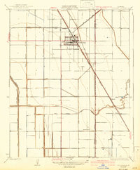
1928 Map of Corcoran
USGS Topo · Published 1942About this map
The agricultural heart of the San Joaquin Valley is meticulously detailed in this survey by S.B.O'Hara, showing the region in the late 1920s. Centered on Corcoran, the map reveals a landscape defined by an intensive irrigation network, featuring the Sweet Canal, Dairy Avenue Canal, and numerous ditches like the West Corcoran Ditch. This infrastructure highlights the transformation of the arid basin into a productive farming hub. The Atchison Topeka and Santa Fe railroad cuts diagonally across the grid, serving as the primary artery for moving the valley's produce.
Find a feature on this map
27 named features on this map. Tap any name to fly to it.
Don’t see what you’re looking for? This feature index may not catch every label — zoom into the map to look around manually.
Map Details
Editions of this 1928 Corcoran Map
3 editions found
Other maps of this area

1914 · Lost Hills
USGS Topo · 1:125,000

1927 · Lake View School
USGS Topo · 1:31,680

1927 · Paige
USGS Topo · 1:31,680

1928 · Waukena
USGS Topo · 1:31,680

1928 · Corcoran
USGS Topo · 1:31,680

1929 · Alpaugh
USGS Topo · 1:31,680

1929 · Guernsey
USGS Topo · 1:31,680

1929 · West Alpaugh
USGS Topo · 1:31,680

1931 · Harvester
USGS Topo · 1:31,680

1932 · El Rico Ranch
USGS Topo · 1:31,680