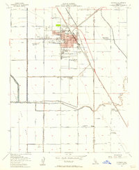
1954 Map of Corcoran
USGS Topo · Published 1957About this map
Agricultural development and industrial processing define the landscape around Corcoran during the mid-1950s. The town serves as a central hub for the Tulare Lake Basin, evidenced by the numerous Grain Elevators and the prominent route of the Atchison Topeka and Santa Fe railroad. The map reveals a specialized labor geography through named worker settlements like Crockett and Gambogy Labor Camp, Salyer Farms Camp One, and Boswell Camp One, illustrating the large-scale ranching operations that replaced the waters of the former lake bed.
Find a feature on this map
46 named features on this map. Tap any name to fly to it.
Don’t see what you’re looking for? This feature index may not catch every label — zoom into the map to look around manually.
Map Details
Editions of this 1954 Corcoran Map
3 editions found
Other maps of this area

1914 · Lost Hills
USGS Topo · 1:125,000

1927 · Lake View School
USGS Topo · 1:31,680

1927 · Paige
USGS Topo · 1:31,680

1928 · Waukena
USGS Topo · 1:31,680

1928 · Corcoran
USGS Topo · 1:31,680

1929 · Alpaugh
USGS Topo · 1:31,680

1929 · Guernsey
USGS Topo · 1:31,680

1929 · West Alpaugh
USGS Topo · 1:31,680

1931 · Harvester
USGS Topo · 1:31,680

1932 · El Rico Ranch
USGS Topo · 1:31,680