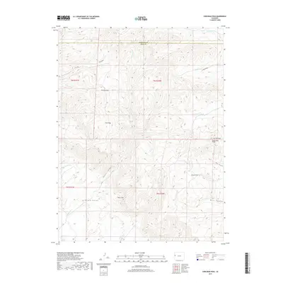
2019 Map of Corcoran Peak
USGS Topo · Published 2019About this map
The Book Cliffs dominate the southern half of this landscape, creating a dramatic physical boundary between the high plateaus and the lower basin. This 2019 survey documents the complex drainage systems that carve through the arid terrain of Mesa and Garfield counties, including the winding Little Salt Wash and Corcoran Wash. The map reveals a high-elevation landscape defined by prominent landforms such as Garfield Mesa, Ross Ridge, and the namesake Corcoran Peak at the eastern edge.
Find a feature on this map
28 named features on this map. Tap any name to fly to it.
Don’t see what you’re looking for? This feature index may not catch every label — zoom into the map to look around manually.
Map Details
Editions of this 2019 Corcoran Peak Map
This is the sole edition of this map. No revisions or reprints were ever made.
Other maps of this area

1929 · Roan Creek
USGS Topo · 1:62,500

1956 · Grand Junction
USGS Topo · 1:250,000

1959 · Grand Junction
USGS Topo · 1:250,000

1960 · Grand Junction
USGS Topo · 1:250,000

1962 · Grand Junction
USGS Topo · 1:250,000

1962 · Fruita
USGS Topo · 1:24,000
1962 · Round Mountain
USGS Topo · 1:24,000

1962 · Corcoran Point
USGS Topo · 1:24,000

1964 · Grand Junction
USGS Topo · 1:250,000

1965 · Grand Junction
USGS Topo · 1:250,000