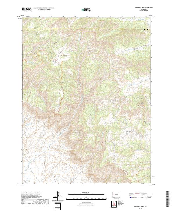
2022 Map of Corcoran Peak
USGS Topo · Published 2022About this map
Grand Valley and the northern reaches of the Book Cliffs dominate this 2022 survey of the high desert landscape along the border of Garfield and Mesa counties. The map captures a rugged topography of rising plateaus and deep drainages, centered on the prominent Corcoran Peak and the southern slopes of Garfield Mesa. A network of backcountry trails like the Skywalker Trl, Cicada Ridge Trl, and Cloud City Trl winds across Ross Ridge, illustrating the modern recreational footprint on these public lands. Significant watercourses including Little Salt Wash, Corcoran Wash, and Pine Gulch reveal the natural erosion patterns that have carved out the Main Canyon and Hunter Canyon. This map provides a precise record of the landforms and access roads as they exist in the early twenty-first century.
Find a feature on this map
33 named features on this map. Tap any name to fly to it.
Don’t see what you’re looking for? This feature index may not catch every label — zoom into the map to look around manually.
Map Details
Editions of this 2022 Corcoran Peak Map
This is the sole edition of this map. No revisions or reprints were ever made.
Other maps of this area

1929 · Roan Creek
USGS Topo · 1:62,500

1956 · Grand Junction
USGS Topo · 1:250,000

1959 · Grand Junction
USGS Topo · 1:250,000

1960 · Grand Junction
USGS Topo · 1:250,000

1962 · Grand Junction
USGS Topo · 1:250,000

1962 · Fruita
USGS Topo · 1:24,000
1962 · Round Mountain
USGS Topo · 1:24,000

1962 · Corcoran Point
USGS Topo · 1:24,000

1964 · Grand Junction
USGS Topo · 1:250,000

1965 · Grand Junction
USGS Topo · 1:250,000