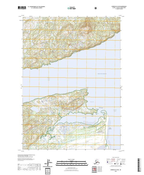
2024 Map of Cordova B-6 NW
USGS Topo · Published 2024About this map
Hawkins Island and Hinchinbrook Island dominate this coastal survey of the Prince William Sound region. The landscape is defined by the narrow Hawkins Island Cutoff and the Strawberry Channel, which separate these landmasses from the open Gulf of Alaska. Remote infrastructure is visible in the form of the Boswell Bay Airport and the Strawberry Point Airport, indicating the critical role of aviation in accessing these isolated stretches of the Chugach National Forest.
Find a feature on this map
25 named features on this map. Tap any name to fly to it.
Don’t see what you’re looking for? This feature index may not catch every label — zoom into the map to look around manually.
Map Details
Editions of this 2024 Cordova B-6 NW Map
This is the sole edition of this map. No revisions or reprints were ever made.
Other maps of this area

1948 · Cordova
USGS Topo · 1:250,000

1950 · Cordova C-7
USGS Topo · 1:63,360

1950 · Cordova C-6
USGS Topo · 1:63,360

1950 · Cordova B-7
USGS Topo · 1:63,360

1951 · Cordova
USGS Topo · 1:250,000

1951 · Cordova B-6
USGS Topo · 1:63,360

1953 · Cordova C-6
USGS Topo · 1:63,360

1953 · Cordova B-7
USGS Topo · 1:63,360
1953 · Cordova C-7
USGS Topo · 1:63,360

1953 · Cordova B-6
USGS Topo · 1:63,360