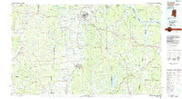
1984 Map of Corinth
USGS Topo · Published 1984About this map
Corinth stands as a primary crossroads in the northeastern corner of Mississippi, where the Illinois Central Gulf and Southern rail lines intersect. This 1984 survey documents the region's complex hydrological and topographic landscape, dominated by the Tennessee Divide, which separates the drainage of the Tennessee River and Pickwick Lake from the westward-flowing waters of the Hatchie River and Tuscumbia River. The map captures the transition from the rolling timberlands of the Holly Springs National Forest in the west to the significant elevation of Crow Mountain and the Hatchie Hills near the Alabama border. In addition to major regional centers like Booneville and Ripley, smaller settlements such as Jacinto and Burnsville are situated along a network of roads and rail corridors that define the local economy. The historic Natchez Trace Parkway cuts across the southern portion of the sheet, providing a modern link through a landscape historically defined by its river basins and ridges.
Find a feature on this map
98 named features on this map. Tap any name to fly to it.
Don’t see what you’re looking for? This feature index may not catch every label — zoom into the map to look around manually.
Map Details
Editions of this 1984 Corinth Map
This is the sole edition of this map. No revisions or reprints were ever made.
Other maps of this area

1905 · Waynesboro
USGS Topo · 1:125,000

1911 · Iuka
USGS Topo · 1:48,000

1914 · Iuka
USGS Topo · 1:62,500

1921 · Booneville
USGS Topo · 1:48,000

1921 · Tupelo
USGS Topo · 1:48,000

1922 · Booneville
USGS Topo · 1:62,500

1923 · Tupelo
USGS Topo · 1:62,500

1924 · Gravelly Springs
USGS Topo · 1:48,000

1925 · Barton
USGS Topo · 1:62,500

1926 · Barton
USGS Topo · 1:48,000