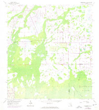
1958 Map of Corkscrew NW
USGS Topo · Published 1974About this map
The Corkscrew Swamp Sanctuary dominates the southern landscape of this Florida region, marking a significant ecological conservation area where the Lee Co and Collier Co boundaries meet. This survey, based on 1951 aerial photographs and 1958 field work, reveals a wet interior environment punctuated by features like Panther Island and a Flowing Well. The 1973 revisions highlight a changing landscape, specifically where human-made drainage patterns and agricultural grids begin to interface with the natural swamp sanctuary. The map illustrates the transition from the wilderness of the Corkscrew Swamp Sanctuary to the early development of surveyed land lines in the north, providing a window into South Florida's mid-century environmental management.
Find a feature on this map
4 named features on this map. Tap any name to fly to it.
Don’t see what you’re looking for? This feature index may not catch every label — zoom into the map to look around manually.
Map Details
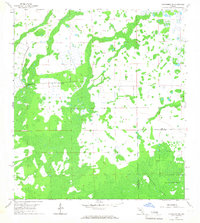
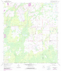
Editions of this 1958 Corkscrew NW Map
4 editions found
Other maps of this area

1956 · West Palm Beach
USGS Topo · 1:250,000

1957 · West Palm Beach
USGS Topo · 1:250,000

1958 · West Palm Beach
USGS Topo · 1:250,000

1958 · Corkscrew SE
USGS Topo · 1:24,000

1958 · Bonita Springs
USGS Topo · 1:24,000

1958 · Corkscrew NW
USGS Topo · 1:24,000

1958 · Estero
USGS Topo · 1:24,000

1958 · Alva SW
USGS Topo · 1:24,000

1958 · Corkscrew SW
USGS Topo · 1:24,000

1958 · Alva SE
USGS Topo · 1:24,000