
1958 Map of Corkscrew SW
USGS Topo · Published 1959About this map
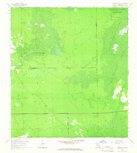
Corkscrew Swamp Sanctuary dominates the northeastern reaches of this Florida landscape, preserving a vast wetland ecosystem as it existed in the late 1950s. The topography is defined by the subtle hydrology of the western Everglades, where the Bird Rookery Swamp and Horseshoe Marsh illustrate the intricate drainage patterns of the region. Spanning the Lee and Collier County boundary, the map provides a look at an area largely untouched by the massive residential developments that would later transform southwest Florida. The survey records the intricate network of cypress strands and marshes during an era when much of the interior remained unsurveyed and accessible only through private property lines and rugged trails, long before modern drainage projects altered the flow of the local watershed.
Find a feature on this map
4 named features on this map. Tap any name to fly to it.
Don’t see what you’re looking for? This feature index may not catch every label — zoom into the map to look around manually.
Map Details
Editions of this 1958 Corkscrew SW Map
4 editions found
Other maps of this area

1956 · West Palm Beach
USGS Topo · 1:250,000

1957 · West Palm Beach
USGS Topo · 1:250,000

1958 · West Palm Beach
USGS Topo · 1:250,000

1958 · Corkscrew SE
USGS Topo · 1:24,000

1958 · Bonita Springs
USGS Topo · 1:24,000

1958 · Corkscrew NW
USGS Topo · 1:24,000

1958 · Estero
USGS Topo · 1:24,000

1958 · Belle Meade NE
USGS Topo · 1:24,000

1958 · Belle Meade NW
USGS Topo · 1:24,000

1958 · Naples North
USGS Topo · 1:24,000
Featured Places
- Bonita National Golf & Country Club, FL
- Village Walk, FL
- Quail West, FL
- Bonita Landing, FL
- Hunters Ridge, FL