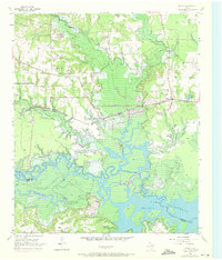
1955 Map of Corley
USGS Topo · Published 1971About this map
Lake Texarkana dominates the southern landscape of this mid-century survey, where the Sulphur River and Thomas Creek meet at the boundary of Bowie and Cass Counties. The topography reveals a transition from the low-lying wetlands and islands of the reservoir to the elevated ground of White Oak Ridge. The northern half of the quadrangle is defined by the St Louis Southwestern Railroad, which connects the small settlements of Simms, Carbondale, and Corley.
Find a feature on this map
30 named features on this map. Tap any name to fly to it.
Don’t see what you’re looking for? This feature index may not catch every label — zoom into the map to look around manually.
Map Details
Editions of this 1955 Corley Map
Other maps of this area

1909 · New Boston
USGS Topo · 1:62,500

1910 · Linden
USGS Topo · 1:62,500

1914 · Daingerfield
USGS Topo · 1:62,500

1930 · Bassett
USGS Topo · 1:62,500

1953 · Texarkana
USGS Topo · 1:250,000

1954 · New Boston
USGS Topo · 1:24,000

1954 · Hooks
USGS Topo · 1:24,000

1955 · Corley
USGS Topo · 1:24,000

1955 · Maud
USGS Topo · 1:24,000

1955 · New Boston
USGS Topo · 1:62,500