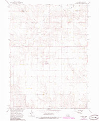
1966 Map of Cornlea
USGS Topo · Published 1985About this map
Cornlea sits at the center of this agricultural landscape in Platte County, mapped during the mid-1960s as part of the Department of the Interior’s program for the Missouri River Basin. The town is marked by the Sacred Heart Cem and a prominent Tower, serving as a localized hub for the surrounding farmsteads. The transport geography of the area is particularly noteworthy, showing the Old Railroad Grade cutting across the terrain, alongside the active Union Pacific line.
Find a feature on this map
11 named features on this map. Tap any name to fly to it.
Don’t see what you’re looking for? This feature index may not catch every label — zoom into the map to look around manually.
Map Details
Editions of this 1966 Cornlea Map
2 editions found
Other maps of this area

1955 · Fremont
USGS Topo · 1:250,000

1957 · Fremont
USGS Topo · 1:250,000

1958 · Fremont
USGS Topo · 1:250,000

1963 · Madison
USGS Topo · 1:24,000

1963 · Battle Creek SE
USGS Topo · 1:24,000

1963 · Battle Creek SW
USGS Topo · 1:24,000

1966 · Tarnov
USGS Topo · 1:24,000
1966 · Lindsay SW
USGS Topo · 1:24,000

1966 · Platte Center
USGS Topo · 1:24,000
1966 · Lindsay
USGS Topo · 1:24,000