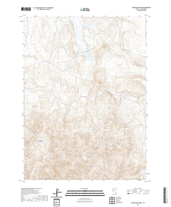
2021 Map of Cornucopia Ridge
USGS Topo · Published 2021About this map
Cornucopia Ridge and Silver Peak define the high elevations of this Elko County landscape, where complex drainage patterns reveal the arid character of northeastern Nevada. Water sources are vital landmarks here, with Allen Spring and Sulphur Spring providing essential points of interest for those studying the regional geography. The rugged terrain transitions into the Wild Horse Basin, a notable topographical depression in the western portion of the map. Tracing the courses of Deep Creek, Sulphur Cr, and Granite Cr shows how seasonal flow has shaped the land within the Public Land Survey System grids of T43N and T42N. This survey provides a precise look at the undeveloped high desert before more recent land use changes, preserving the locations of specific springs and peaks used by generations of land managers and local travelers.
Find a feature on this map
13 named features on this map. Tap any name to fly to it.
Don’t see what you’re looking for? This feature index may not catch every label — zoom into the map to look around manually.
Map Details
Editions of this 2021 Cornucopia Ridge Map
This is the sole edition of this map. No revisions or reprints were ever made.
Other maps of this area

1955 · McDermitt
USGS Topo · 1:250,000

1956 · Tuscarora
USGS Topo · 1:62,500

1956 · Mt. Blitzen
USGS Topo · 1:62,500

1956 · Bull Run
USGS Topo · 1:62,500

1959 · McDermitt
USGS Topo · 1:250,000

1964 · Wilson Reservoir
USGS Topo · 1:62,500

1982 · Bull Run Mts
USGS Topo · 1:100,000

1982 · Tuscarora
USGS Topo · 1:100,000
1987 · Cottonwood Peak
USGS Topo · 1:24,000
1987 · Fourmile Butte
USGS Topo · 1:24,000