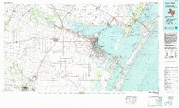
1984 Map of Corpus Christi
USGS Topo · Published 1984About this map
The coastal sweep of Corpus Christi and its neighboring barrier islands are captured in detail during the mid-1980s, showcasing the complex relationship between deep-water shipping channels and the shallow waters of Nueces Bay and Corpus Christi Bay. This survey highlights the region's mid-century institutional and military expansion, featuring the Corpus Christi Naval Air Station and academic centers like Texas A&I University. The industrial footprint of the Texas coast is evidenced by the intersection of the Missouri Pacific and Southern Pacific railroads serving the port.
Find a feature on this map
74 named features on this map. Tap any name to fly to it.
Don’t see what you’re looking for? This feature index may not catch every label — zoom into the map to look around manually.
Map Details
Editions of this 1984 Corpus Christi Map
This is the sole edition of this map. No revisions or reprints were ever made.
Other maps of this area

1917 · Ben Bolt
USGS Topo · 1:62,500

1920 · Mikeska
USGS Topo · 1:125,000

1920 · San Diego
USGS Topo · 1:62,500

1921 · Falfurrias
USGS Topo · 1:125,000

1924 · Petronilla
USGS Topo · 1:62,500

1925 · Robstown
USGS Topo · 1:62,500

1925 · Aransas Pass
USGS Topo · 1:62,500

1925 · Mathis No. 3
USGS Topo · 1:48,000

1925 · Oso Creek
USGS Topo · 1:62,500

1925 · Corpus Christi
USGS Topo · 1:62,500