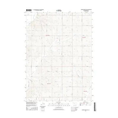
2015 Map of Correctionville SE
USGS Topo · Published 2015About this map
Little Sioux River anchors the northwest corner of this Woodbury County landscape, where the terrain breaks away from the river valley into a high network of drainage systems. This 2015 survey reveals a strictly organized section-line road grid, including 280th St and 300th St, that overlays a complex topography of ridges and draws. Named watercourses like Miller Cr, Keller Cr, and Hawk Cr define the watershed as it moves southeast toward the wider basin. Local transit is facilitated by established routes such as Co Hwy L22 and the Danbury Blacktop. For those studying the rural development of the region, the map provides a clear picture of how modern agriculture and infrastructure navigate the various creeks, including Dutch Cr and Reynolds Cr, which remain the primary natural landmarks of the township.
Find a feature on this map
27 named features on this map. Tap any name to fly to it.
Don’t see what you’re looking for? This feature index may not catch every label — zoom into the map to look around manually.
Map Details
Editions of this 2015 Correctionville SE Map
This is the sole edition of this map. No revisions or reprints were ever made.
Other maps of this area

1954 · Fort Dodge
USGS Topo · 1:250,000

1957 · Fort Dodge
USGS Topo · 1:250,000

1958 · Fort Dodge
USGS Topo · 1:250,000

1969 · Danbury
USGS Topo · 1:24,000

1969 · Holstein SW
USGS Topo · 1:24,000

1969 · Mapleton
USGS Topo · 1:24,000

1969 · Correctionville NW
USGS Topo · 1:24,000

1969 · Correctionville
USGS Topo · 1:24,000

1969 · Cushing
USGS Topo · 1:24,000
1969 · Smithland
USGS Topo · 1:24,000