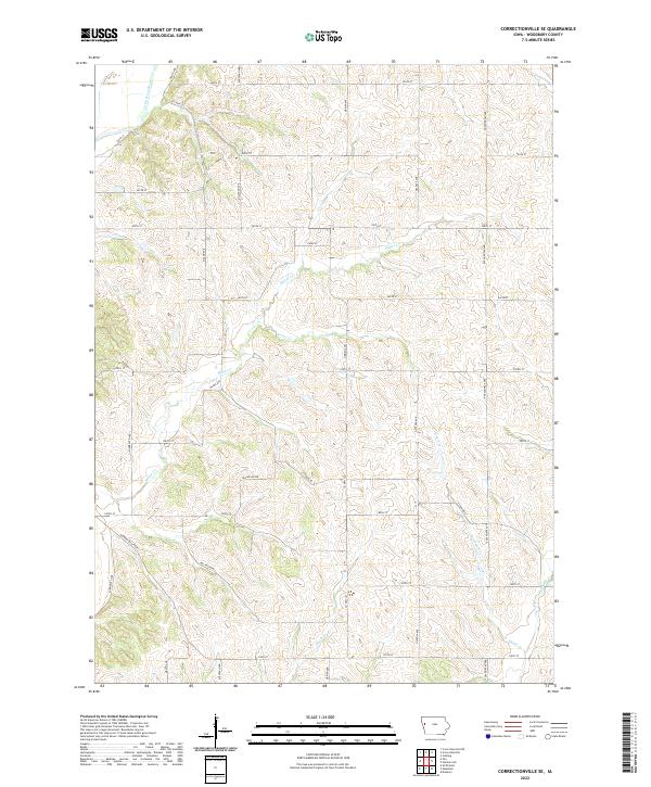
2022 Map of Correctionville SE
USGS Topo · Published 2022About this map
The Little Sioux River anchors the northwest corner of this Woodbury County landscape, where the terrain transitions into a dense network of creek valleys and upland ridges. The drainage patterns are defined by several named tributaries including Miller Cr, Keller Cr, and Dutch Cr, which carve through the agricultural sections of the Loess Hills region. Unlike the grid-heavy prairie elsewhere, the topography here forces a more complex road system that follows natural contours and stream beds.
Find a feature on this map
31 named features on this map. Tap any name to fly to it.
Don’t see what you’re looking for? This feature index may not catch every label — zoom into the map to look around manually.
Map Details
Editions of this 2022 Correctionville SE Map
This is the sole edition of this map. No revisions or reprints were ever made.
Other maps of this area

1954 · Fort Dodge
USGS Topo · 1:250,000

1957 · Fort Dodge
USGS Topo · 1:250,000

1958 · Fort Dodge
USGS Topo · 1:250,000

1969 · Danbury
USGS Topo · 1:24,000

1969 · Holstein SW
USGS Topo · 1:24,000

1969 · Mapleton
USGS Topo · 1:24,000

1969 · Correctionville NW
USGS Topo · 1:24,000

1969 · Correctionville
USGS Topo · 1:24,000

1969 · Cushing
USGS Topo · 1:24,000
1969 · Smithland
USGS Topo · 1:24,000