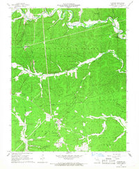
1967 Map of Corridon
USGS Topo · Published 1968About this map
The West Fork Black River and its numerous tributaries, such as Bee Fork and Logan Creek, dictate the settlement patterns of this Reynolds County landscape during the late 1960s. Within the Clark National Forest, small community hubs like Reynolds and Corridon serve as focal points for local life, supported by the Corridon-Reynolds Sch and spiritual centers including Ohlman Ch and Bee Fork Ch. Industrial activity is evident near the river forks, where the Fletcher Mine and associated Tailings Pond operate alongside specialized features like Charcoal Ovens and the Jay Lookout Tower. The map provides a detailed look at the rural infrastructure of the era, from the Fletcher Landing Strip to numerous family-named burial grounds like Mayes Cem and Corridon-Reynolds Cem, reflecting a deep-rooted connection to the hollows and ridges of the Ozarks.
Find a feature on this map
54 named features on this map. Tap any name to fly to it.
Don’t see what you’re looking for? This feature index may not catch every label — zoom into the map to look around manually.
Map Details
Editions of this 1967 Corridon Map
3 editions found
Other maps of this area

1924 · Edgehill
USGS Topo · 1:62,500

1926 · Edgehill
USGS Topo · 1:62,500

1943 · Lesterville
USGS Topo · 1:62,500

1943 · Boss
USGS Topo · 1:62,500

1944 · Corridon
USGS Topo · 1:62,500

1946 · Lesterville
USGS Topo · 1:62,500

1946 · Boss
USGS Topo · 1:62,500

1947 · Corridon
USGS Topo · 1:62,500

1949 · Rolla
USGS Topo · 1:250,000

1953 · Rolla
USGS Topo · 1:250,000