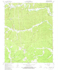
1967 Map of Corridon
USGS Topo · Published 1980About this map
Clark National Forest dominates this section of Reynolds County, where the terrain is carved by the Black River and its numerous tributaries. The map documents the mid-century social and industrial landscape of the Ozarks, centered around the small settlements of Reynolds and Corridon. Evidence of local industry is visible through the Fletcher Mine and a series of Charcoal Ovens located near the town of Reynolds, while the Jay Lookout Tower stands as a sentinel over the wooded ridges.
Find a feature on this map
56 named features on this map. Tap any name to fly to it.
Don’t see what you’re looking for? This feature index may not catch every label — zoom into the map to look around manually.
Map Details
Editions of this 1967 Corridon Map
3 editions found
Other maps of this area

1924 · Edgehill
USGS Topo · 1:62,500

1926 · Edgehill
USGS Topo · 1:62,500

1943 · Lesterville
USGS Topo · 1:62,500

1943 · Boss
USGS Topo · 1:62,500

1944 · Corridon
USGS Topo · 1:62,500

1946 · Lesterville
USGS Topo · 1:62,500

1946 · Boss
USGS Topo · 1:62,500

1947 · Corridon
USGS Topo · 1:62,500

1949 · Rolla
USGS Topo · 1:250,000

1953 · Rolla
USGS Topo · 1:250,000