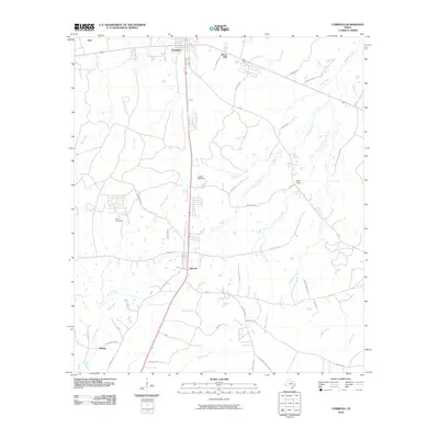
2010 Map of Corrigan
USGS Topo · Published 2010About this map
Corrigan serves as the primary hub of this East Texas landscape, where the intersection of regional thoroughfares and a complex network of creeks defines the local geography. The settlement patterns extend to smaller communities like Moscow and Bering, which are connected by a web of rural routes including Old Hwy 35 N and Midland Rd. These smaller locales, along with curiously named spots like Asia and Snow Hill, reflect the dispersed nature of late-twentieth-century development in the piney woods.
Find a feature on this map
52 named features on this map. Tap any name to fly to it.
Don’t see what you’re looking for? This feature index may not catch every label — zoom into the map to look around manually.
Map Details
Editions of this 2010 Corrigan Map
This is the sole edition of this map. No revisions or reprints were ever made.
Other maps of this area

1927 · Lufkin 4-c
USGS Topo · 1:24,000

1932 · Manning
USGS Topo · 1:62,500

1953 · Palestine
USGS Topo · 1:250,000

1954 · Beaumont
USGS Topo · 1:250,000

1955 · Camden
USGS Topo · 1:62,500

1955 · New Willard
USGS Topo · 1:62,500

1957 · Beaumont
USGS Topo · 1:250,000

1957 · Palestine
USGS Topo · 1:250,000
1963 · Trevat
USGS Topo · 1:24,000
1963 · Wakefield
USGS Topo · 1:24,000