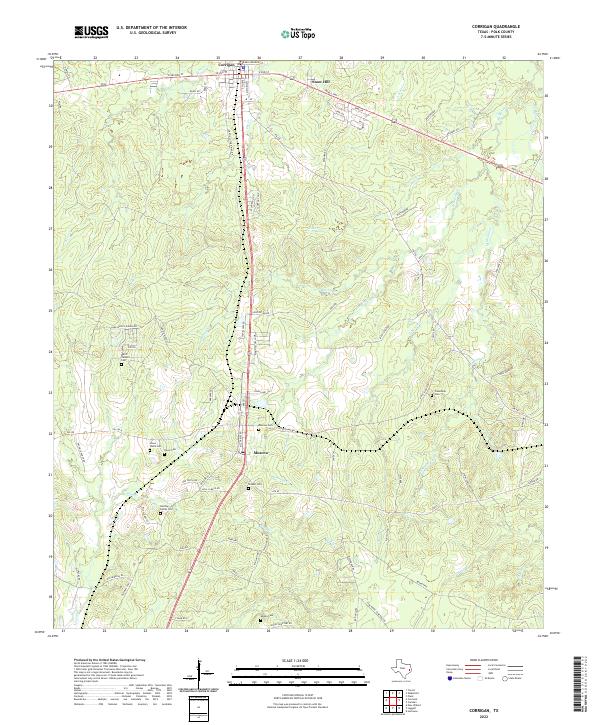
2022 Map of Corrigan
USGS Topo · Published 2022About this map
Moscow and the northern outskirts of Corrigan anchor this portion of Polk County, where the landscape is defined by the headwaters of numerous creeks like Jones Cr and Brushy Cr. The map reveals a high density of small family and community burial sites, including the Moscow Cem, Shiloah Cem, and Friendship Cem, which serve as vital landmarks for genealogical research in this rural Texas corridor.
Find a feature on this map
86 named features on this map. Tap any name to fly to it.
Don’t see what you’re looking for? This feature index may not catch every label — zoom into the map to look around manually.
Map Details
Editions of this 2022 Corrigan Map
This is the sole edition of this map. No revisions or reprints were ever made.
Other maps of this area

1927 · Lufkin 4-c
USGS Topo · 1:24,000

1932 · Manning
USGS Topo · 1:62,500

1953 · Palestine
USGS Topo · 1:250,000

1954 · Beaumont
USGS Topo · 1:250,000

1955 · Camden
USGS Topo · 1:62,500

1955 · New Willard
USGS Topo · 1:62,500

1957 · Beaumont
USGS Topo · 1:250,000

1957 · Palestine
USGS Topo · 1:250,000
1963 · Trevat
USGS Topo · 1:24,000
1963 · Wakefield
USGS Topo · 1:24,000