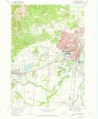
1969 Map of Corvallis
USGS Topo · Published 1973About this map
The Willamette River and Marys River converge near the heart of Corvallis, marking a landscape where early agriculture, academic growth, and timber interests meet. Dominating the western horizon, McDonald State Forest and prominent peaks like Dimple Hill and Bald Hill overlook the expanding valley floor. The influence of Oregon State Univ is central to the town's layout, complete with its Stadium and research infrastructure.
Find a feature on this map
70 named features on this map. Tap any name to fly to it.
Don’t see what you’re looking for? This feature index may not catch every label — zoom into the map to look around manually.
Map Details
Editions of this 1969 Corvallis Map
3 editions found
Other maps of this area

1911 · Inavale
USGS Topo · 1:31,680

1912 · Halsey
USGS Topo · 1:62,500

1913 · Philomath
USGS Topo · 1:31,680

1913 · Oakville
USGS Topo · 1:31,680

1913 · Wells
USGS Topo · 1:31,680

1914 · Soap Creek
USGS Topo · 1:31,680

1916 · Albany
USGS Topo · 1:62,500

1921 · Corvallis
USGS Topo · 1:62,500

1922 · Monroe
USGS Topo · 1:62,500

1939 · Monroe
USGS Topo · 1:62,500