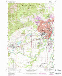
1969 Map of Corvallis
USGS Topo · Published 1987About this map
The Willamette River and Marys River converge in this mid-century portrait of a growing university town and its neighboring timberlands. The sprawling campus of Oregon State University serves as a central anchor, buffered by the dense elevations of the Mc Donald Forest to the north and the prominent Bald Hill. This 1960s survey, with photorevisions from the 1980s, documents the expansion of Corvallis eastward toward the Linn County line and westward along the Southern Pacific railroad toward Philomath.
Find a feature on this map
82 named features on this map. Tap any name to fly to it.
Don’t see what you’re looking for? This feature index may not catch every label — zoom into the map to look around manually.
Map Details
Editions of this 1969 Corvallis Map
3 editions found
Other maps of this area

1911 · Inavale
USGS Topo · 1:31,680

1912 · Halsey
USGS Topo · 1:62,500

1913 · Philomath
USGS Topo · 1:31,680

1913 · Oakville
USGS Topo · 1:31,680

1913 · Wells
USGS Topo · 1:31,680

1914 · Soap Creek
USGS Topo · 1:31,680

1916 · Albany
USGS Topo · 1:62,500

1921 · Corvallis
USGS Topo · 1:62,500

1922 · Monroe
USGS Topo · 1:62,500

1939 · Monroe
USGS Topo · 1:62,500