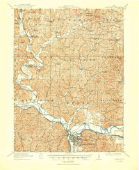
1915 Map of Coshocton
USGS Topo · Published 1950About this map
The confluence of the Walhonding River and Tuscarawas River defines the industrial and geographic heart of this central Ohio region. Near the southern edge, Coshocton and the town of Roscoe stand at the junction where these waters form the Muskingum River. Traces of the historic Ohio Canal are clearly visible, including the Upper, Middle, and Lower Basin near Canal Lewisville, reflecting the importance of water transport and hydraulic power in the early 20th century.
Find a feature on this map
99 named features on this map. Tap any name to fly to it.
Don’t see what you’re looking for? This feature index may not catch every label — zoom into the map to look around manually.
Map Details
Editions of this 1915 Coshocton Map
2 editions found

Other maps of this area

1908 · Conesville
USGS Topo · 1:62,500

1909 · Cambridge
USGS Topo · 1:62,500

1910 · Frazeysburg
USGS Topo · 1:62,500

1910 · Conesville
USGS Topo · 1:62,500

1911 · Newcomerstown
USGS Topo · 1:62,500

1912 · Cambridge
USGS Topo · 1:62,500

1912 · Loudonville
USGS Topo · 1:62,500

1913 · Newcomerstown
USGS Topo · 1:62,500

1913 · Brinkhaven
USGS Topo · 1:62,500

1913 · Coshocton
USGS Topo · 1:62,500