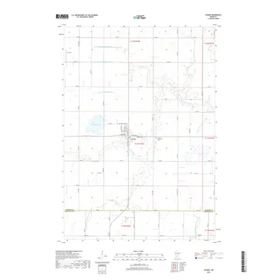
2019 Map of Cosmos
USGS Topo · Published 2019About this map
The town of Cosmos serves as the focal point of this Meeker County landscape, where celestial-themed street names like Northern Cross Ave, Neptune ST, and Milkyway St S reflect the community's unique identity. The surrounding terrain is defined by a sophisticated agricultural drainage network, including Judicial Ditch Number One and Judicial Ditch Number Eighteen, which manage the water levels of the low-lying prairie. The S Fork Crow River meanders through the central region, passing near the Peace Cem and the Cosmos Community Cem. To the west, Thompson Lake provides a notable basin amidst the rectilinear grid of county roads. Further north, Belle Cr flows through the township lines, while the Lux Strip landing area indicates the local reliance on light aircraft for regional connectivity across the rural expanse.
Find a feature on this map
61 named features on this map. Tap any name to fly to it.
Don’t see what you’re looking for? This feature index may not catch every label — zoom into the map to look around manually.
Map Details
Editions of this 2019 Cosmos Map
This is the sole edition of this map. No revisions or reprints were ever made.
Other maps of this area

1953 · New Ulm
USGS Topo · 1:250,000

1953 · Saint Cloud
USGS Topo · 1:250,000

1956 · Atwater
USGS Topo · 1:62,500

1957 · Saint Cloud
USGS Topo · 1:250,000

1957 · New Ulm
USGS Topo · 1:250,000

1957 · Olivia
USGS Topo · 1:62,500

1958 · New Ulm
USGS Topo · 1:250,000

1958 · Saint Cloud
USGS Topo · 1:250,000

1967 · New Ulm
USGS Topo · 1:250,000

1967 · Churchill
USGS Topo · 1:24,000