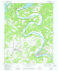
1972 Map of Cotter
USGS Topo · Published 1982About this map
Bull Shoals Lake dominates the northern reaches of this landscape, held back by the massive Bull Shoals Dam and its adjacent Powerplant. Downstream, the White River carves a deep, winding course between Marion and Baxter Counties, passing notable landmarks like Cane Island and Bayless Island. This era captures the region's mid-century development, where the recreational draw of the Bull Shoals State Park and Gaston Landing Strip exists alongside established railroad towns.
Find a feature on this map
49 named features on this map. Tap any name to fly to it.
Don’t see what you’re looking for? This feature index may not catch every label — zoom into the map to look around manually.
Map Details
Editions of this 1972 Cotter Map
3 editions found
Other maps of this area

1890 · Mountain Home
USGS Topo · 1:125,000

1891 · Mountain Home
USGS Topo · 1:125,000

1893 · Yellville
USGS Topo · 1:125,000

1894 · Mountain Home
USGS Topo · 1:125,000

1903 · Yellville
USGS Topo · 1:125,000

1905 · Yellville
USGS Topo · 1:125,000

1929 · Yellville
USGS Topo · 1:125,000

1945 · Harrison
USGS Topo · 1:250,000

1949 · Harrison
USGS Topo · 1:250,000

1954 · Harrison
USGS Topo · 1:250,000