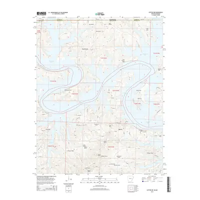
2014 Map of Cotter NW
USGS Topo · Published 2014About this map
Bull Shoals Lake dominates this northern Arkansas landscape, its winding shoreline creating a complex network of points and bluffs along the White River system. The 2014 survey reveals a region shaped by both the reservoir and rugged topography, where small settlements like Midway and Pine Branch serve as focal points for local residents. The area's aviation history is visible through facilities such as Totty Field Airport and the Pine Mountain Airpark, reflecting the lake's importance for recreational and residential access.
Find a feature on this map
89 named features on this map. Tap any name to fly to it.
Don’t see what you’re looking for? This feature index may not catch every label — zoom into the map to look around manually.
Map Details
Editions of this 2014 Cotter NW Map
This is the sole edition of this map. No revisions or reprints were ever made.
Other maps of this area

1893 · Yellville
USGS Topo · 1:125,000

1903 · Yellville
USGS Topo · 1:125,000

1905 · Yellville
USGS Topo · 1:125,000

1929 · Yellville
USGS Topo · 1:125,000

1936 · Thornfield
USGS Topo · 1:48,000

1943 · Protem
USGS Topo · 1:62,500

1943 · Thornfield
USGS Topo · 1:62,500

1945 · Harrison
USGS Topo · 1:250,000

1945 · Thornfield
USGS Topo · 1:62,500

1949 · Harrison
USGS Topo · 1:250,000