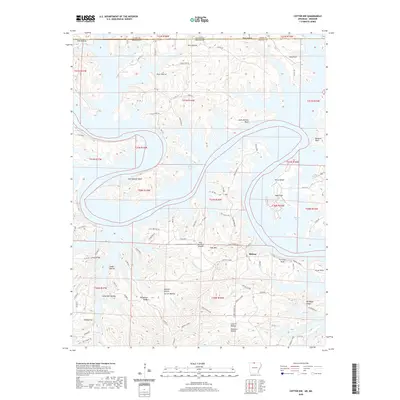
2020 Map of Cotter NW
USGS Topo · Published 2020About this map
Midway sits at the heart of this landscape, where the plateau of the Ozarks meets the complex, winding arms of Bull Shoals Lake. The terrain is defined by deep incisions from waterways like Little Music Cr and the Gunnel Fork, which have carved out distinct topographical features such as Wilson Bluff and Stave Mill Hollow. Along the Missouri-Arkansas border, the map reveals a mosaic of named hollows and ridges that reflect long-standing local nomenclature, including Stallion Hollow and Linley Ridge.
Find a feature on this map
94 named features on this map. Tap any name to fly to it.
Don’t see what you’re looking for? This feature index may not catch every label — zoom into the map to look around manually.
Map Details
Editions of this 2020 Cotter NW Map
This is the sole edition of this map. No revisions or reprints were ever made.
Other maps of this area

1893 · Yellville
USGS Topo · 1:125,000

1903 · Yellville
USGS Topo · 1:125,000

1905 · Yellville
USGS Topo · 1:125,000

1929 · Yellville
USGS Topo · 1:125,000

1936 · Thornfield
USGS Topo · 1:48,000

1943 · Protem
USGS Topo · 1:62,500

1943 · Thornfield
USGS Topo · 1:62,500

1945 · Harrison
USGS Topo · 1:250,000

1945 · Thornfield
USGS Topo · 1:62,500

1949 · Harrison
USGS Topo · 1:250,000