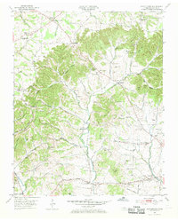
1953 Map of Cottontown
USGS Topo · Published 1969About this map
Cottontown serves as a central hub in this part of Sumner County, positioned where small valley roads converge in a landscape defined by deep ridges and hollows. The area is exceptionally dense with family burial grounds and country institutions, including the Old Friendship Church and Strother Church. This mid-century landscape reflects a deeply established rural social structure, evidenced by several small educational sites like Palmer Chapel Sch and communal gathering spots such as the Liberty Community Hall.
Find a feature on this map
98 named features on this map. Tap any name to fly to it.
Don’t see what you’re looking for? This feature index may not catch every label — zoom into the map to look around manually.
Map Details
Editions of this 1953 Cottontown Map
3 editions found
Other maps of this area

1903 · Nashville
USGS Topo · 1:125,000

1931 · Adolphus
USGS Topo · 1:62,500

1942 · Gallatin
USGS Topo · 1:100,000

1952 · Goodlettsville
USGS Topo · 1:24,000

1952 · Hendersonville
USGS Topo · 1:24,000

1953 · Cottontown
USGS Topo · 1:24,000

1953 · Orlinda
USGS Topo · 1:24,000
1954 · White House
USGS Topo · 1:24,000

1955 · Laguardo
USGS Topo · 1:24,000

1955 · Gallatin
USGS Topo · 1:24,000