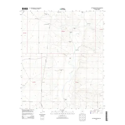
2013 Map of Cottonwood Draw
USGS Topo · Published 2013About this map
The Pecos River carves a winding path through this arid Chaves County landscape, serving as the central geographic feature for a network of ephemeral drainage draws. Historically significant water sources are scattered across the terrain, including Red Spring, Sixmile Spring, and Crockett Spring, which likely dictated the placement of early range improvements. The map illustrates a ranching economy reliant on groundwater, evidenced by named installations such as the River Windmill and several strategic locations like South Well, Badger Well, and Indian Well.
Find a feature on this map
37 named features on this map. Tap any name to fly to it.
Don’t see what you’re looking for? This feature index may not catch every label — zoom into the map to look around manually.
Map Details
Editions of this 2013 Cottonwood Draw Map
This is the sole edition of this map. No revisions or reprints were ever made.
Other maps of this area

1955 · Roswell
USGS Topo · 1:250,000

1958 · Roswell
USGS Topo · 1:250,000

1962 · Roswell
USGS Topo · 1:250,000

1962 · Eightmile Draw
USGS Topo · 1:24,000

1963 · Coyote Draw
USGS Topo · 1:24,000

1967 · Deering Place
USGS Topo · 1:24,000

1967 · Haystack Mountain
USGS Topo · 1:24,000

1967 · Cottonwood Draw
USGS Topo · 1:24,000

1967 · Swallow Nest Canyon
USGS Topo · 1:24,000

1967 · Hernandez Lake
USGS Topo · 1:24,000