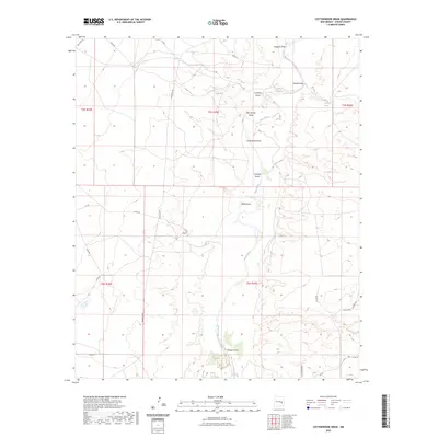
2023 Map of Cottonwood Draw
USGS Topo · Published 2023About this map
The Pecos River carves a winding path through this corner of Chaves County, defining a landscape shaped by intermittent watercourses and high desert drainage. This modern survey illustrates the complex network of arroyos that feed the river system, including the prominent Cottonwood Draw and Bosque Draw. Water sources are sparse but critical in this arid environment, evidenced by named landmarks such as Red Spring, Sixmile Spring, and Crockett Spring. The terrain is partitioned by a grid of rural roads, including Roosevelt Rd and Caprock Rd, which navigate the rises between deep cuts like Alkali Draw and Huggins Draw. This 2023 map reflects the contemporary land management and geographic features of the New Mexico plains, where the names of these dry washes and isolated springs provide the primary orientation for those working or exploring the Pecos valley.
Find a feature on this map
31 named features on this map. Tap any name to fly to it.
Don’t see what you’re looking for? This feature index may not catch every label — zoom into the map to look around manually.
Map Details
Editions of this 2023 Cottonwood Draw Map
This is the sole edition of this map. No revisions or reprints were ever made.
Other maps of this area

1955 · Roswell
USGS Topo · 1:250,000

1958 · Roswell
USGS Topo · 1:250,000

1962 · Roswell
USGS Topo · 1:250,000

1962 · Eightmile Draw
USGS Topo · 1:24,000

1963 · Coyote Draw
USGS Topo · 1:24,000

1967 · Deering Place
USGS Topo · 1:24,000

1967 · Haystack Mountain
USGS Topo · 1:24,000

1967 · Cottonwood Draw
USGS Topo · 1:24,000

1967 · Swallow Nest Canyon
USGS Topo · 1:24,000

1967 · Hernandez Lake
USGS Topo · 1:24,000