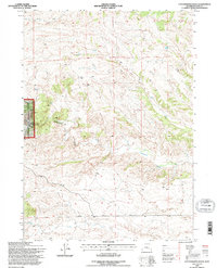
1992 Map of Cottonwood Falls
USGS Topo · Published 1996About this map
Medicine Bow National Forest dominates the western portion of this landscape, where the terrain breaks into a series of drainages and seasonal draws. High-elevation waterways like Cottonwood Creek and Crow Creek carve through the topography, leading toward the namesake Cottonwood Falls. This area is characterized by its drainage networks, including Dagley Creek and Matilda Creek, which illustrate the complex water distribution system of the Wyoming high country.
Find a feature on this map
10 named features on this map. Tap any name to fly to it.
Don’t see what you’re looking for? This feature index may not catch every label — zoom into the map to look around manually.
Map Details
Editions of this 1992 Cottonwood Falls Map
This is the sole edition of this map. No revisions or reprints were ever made.
Other maps of this area

1943 · Esterbrook
USGS Topo · 1:62,500

1945 · Esterbrook
USGS Topo · 1:62,500

1949 · Spring Creek
USGS Topo · 1:24,000

1950 · Spring Creek
USGS Topo · 1:24,000

1950 · Coleman Butte
USGS Topo · 1:24,000

1950 · Cottonwood Falls
USGS Topo · 1:24,000

1951 · Coleman Butte
USGS Topo · 1:24,000

1951 · Sibley Peak
USGS Topo · 1:24,000

1951 · Cottonwood Falls
USGS Topo · 1:24,000

1953 · Lewis Flat
USGS Topo · 1:24,000