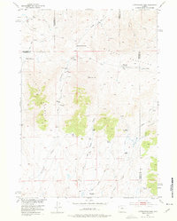
1952 Map of Cottonwood Pass
USGS Topo · Published 1976About this map
Cottonwood Pass and Davis Pass mark the high points of this transition between the eastern edge of the Bighorn Mountains and the northern slopes of Lysite Mountain. In the early 1950s, this landscape was defined by isolated homesteads and ranches, many of which were already marked as abandoned by the time of the field check. The Bader Homestead, Johnson Place, and Henry Place reflect the difficult realities of high-altitude settlement in Wyoming's high desert country. Active sites like Nichols Ranch and Britain Ranch sit near drainage systems like Cottonwood Creek and Snyder Creek, which carve through the terrain. The network of unimproved tracks, such as the No Wood Road, underscores the isolation of these holdings at the junction of Fremont, Hot Springs, and Natrona Counties.
Find a feature on this map
28 named features on this map. Tap any name to fly to it.
Don’t see what you’re looking for? This feature index may not catch every label — zoom into the map to look around manually.
Map Details
Editions of this 1952 Cottonwood Pass Map
3 editions found
Other maps of this area

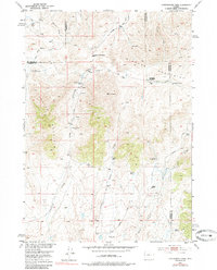
1952 · Cottonwood Pass
USGS Topo · 1:24,000

1952 · Badwater
USGS Topo · 1:24,000

1952 · Lysite
USGS Topo · 1:24,000

1952 · Lysite SE
USGS Topo · 1:24,000

1952 · Sioux Pass
USGS Topo · 1:24,000

1952 · Arapahoe Butte
USGS Topo · 1:24,000

1952 · Battle Mountain
USGS Topo · 1:24,000

1952 · Bull Mountain
USGS Topo · 1:24,000

1955 · Arminto
USGS Topo · 1:250,000

1958 · Arminto
USGS Topo · 1:250,000