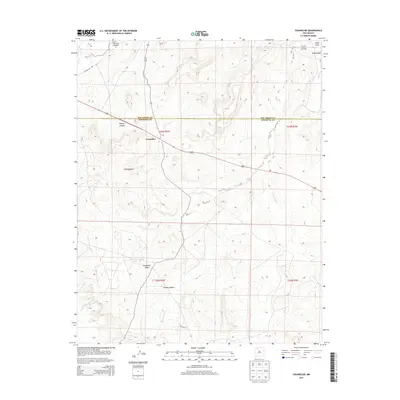
2013 Map of Counselor
USGS Topo · Published 2013About this map
Counselor serves as the primary settlement hub on this 2013 topographic survey, situated at the junction of Highway 550 and NM-403. The landscape is defined by the high desert geography of the Eastern Navajo Agency, where the Rio Arriba Co Sandoval Co line bisects the territory. Industrial activity is prominent in the northern reaches, marked by the extensive San Juan Basin Gas Field near Cañon Largo.
Find a feature on this map
17 named features on this map. Tap any name to fly to it.
Don’t see what you’re looking for? This feature index may not catch every label — zoom into the map to look around manually.
Map Details
Editions of this 2013 Counselor Map
This is the sole edition of this map. No revisions or reprints were ever made.
Other maps of this area

1889 · Largo
USGS Topo · 1:250,000

1895 · Largo
USGS Topo · 1:250,000

1954 · Aztec
USGS Topo · 1:250,000

1958 · Aztec
USGS Topo · 1:250,000

1959 · Nageezi
USGS Topo · 1:62,500

1962 · Aztec
USGS Topo · 1:250,000

1963 · Tayfoya Canyon
USGS Topo · 1:24,000

1963 · Otero Store
USGS Topo · 1:24,000

1965 · Aztec
USGS Topo · 1:250,000
1966 · Tancosa Windmill
USGS Topo · 1:24,000
Featured Places
- Eastern Navajo Agency, NM
- Counselor, Eastern Navajo Agency
- Sandoval County, NM
- Rio Arriba County, NM
- United States