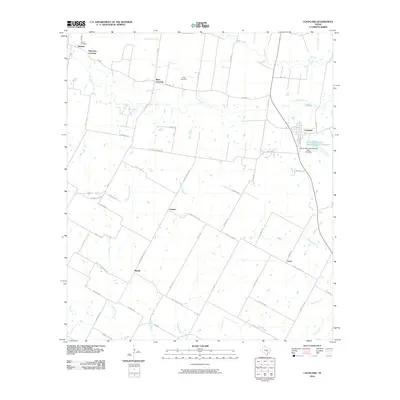
2010 Map of Coupland
USGS Topo · Published 2010About this map
Coupland serves as the primary hub in this eastern Travis County landscape, where the agricultural legacy is etched into the road network. Farm-to-market roads like FM 1660 and FM 973 connect established rural communities, while the paths of Brushy Creek and Willow Creek dictate the contours of the land. Historically significant crossings such as Normans Crossing and Rices Crossing point to early transportation routes across local waterways, anchoring the geography of the region.
Find a feature on this map
60 named features on this map. Tap any name to fly to it.
Don’t see what you’re looking for? This feature index may not catch every label — zoom into the map to look around manually.
Map Details
Editions of this 2010 Coupland Map
This is the sole edition of this map. No revisions or reprints were ever made.
Other maps of this area

1885 · Taylor
USGS Topo · 1:125,000

1885 · Bastrop
USGS Topo · 1:125,000

1887 · Taylor
USGS Topo · 1:125,000

1893 · Georgetown
USGS Topo · 1:125,000

1893 · Bastrop
USGS Topo · 1:125,000

1894 · Taylor
USGS Topo · 1:125,000

1896 · Austin
USGS Topo · 1:125,000

1897 · Austin
USGS Topo · 1:125,000

1904 · Bastrop
USGS Topo · 1:125,000

1910 · Austin
USGS Topo · 1:125,000